Tithe plans and apportionments (1836-1936)
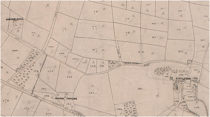
| The Special Collections also hold a complete series of tithe plans and apportionments for County Durham. There are also a large number of altered plans and apportionments dating from 1853. The tithe plans, where they survive, frequently provide the earliest large-scale landed property survey of an area, predating in this part of England the smaller scale Ordnance Survey Old Series by many years. We also hold some earlier enclosure and estate maps, usually relating to Bishopric and Cathedral (Dean & Chapter) estates. The tithe records provide a snapshot of land ownership, land use and settlement patterns. Field names, footpaths, lanes and roads are also recorded, providing a useful link to property deeds. Records survive for urban as well as rural areas of County Durham. Images of all the County Durham tithe apportionments and maps are now freely available online (see the catalogue link below). A key map to the tithe district boundaries, indicating within which district a place was located, is also available: key map.
Tithe records catalogue and background description with bibliography |

Chilton Mansion House, in a detail from the 1838 tithe plan for Chilton township, Merrington parish in County Durham. Ref: DDR/EA/TTH/1/42. |
